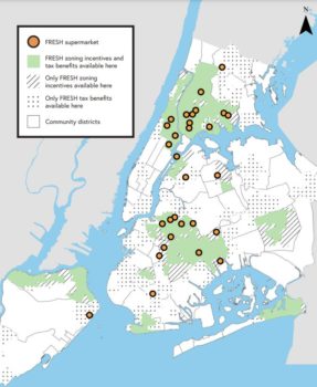
On February 1, 2023, the Department of City Planning updated the progress of the Food Retail Expansion to Support Health program with a new report, “FRESH By the Numbers.”. The Food Retail Expansion to Support Health (“FRESH”) program gives property owners the ability to construct slightly larger buildings in certain districts if the building includes a FRESH supermarket. The program targets neighborhoods that often lack access to fresh produce and other groceries, which … <Read More>
Search Results for: interactive tool
City’s Rainfall Plan to Help New Yorkers Prepare for Severe Weather
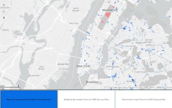
On July 7, 2022, NYC Mayor Eric Adams, along with New York City Department of Environmental Protection Commissioner Rohit T. Aggarwala, and New York City Emergency Management Commissioner Zach Iscol, released the Rainfall Ready NYC action plan. This plan was designed to prepare the City’s government and residents for future extreme rainfall, given current climate changes.
Comptroller’s Office Releases Audit Recommendations Tracker
On July 15, 2022, New York City Comptroller Brad Lander launched the Audit Recommendations Tracker, a new tool accessible to all New Yorkers and used for tracking audit outcomes from January 1, 2022.
City Planning Launches Open House Webpage for Public Engagement with Four Future Bronx Metro-North Stations
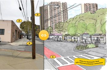
The Department’s ongoing study uses community feedback to assess land use needs in the East Bronx. On April 30, 2021, the Department of City Planning released a new public engagement website for four new future Metro-North train stations in the east Bronx. The Metro-North Stations are planned for the Hunts Point, Parkchester/Van Nest, Morris Park and Co-Op City neighborhoods and will connect with Penn Station and locations further north. Currently, there is information for the … <Read More>
Landmarks Releases Enhanced Online Landmarks Map
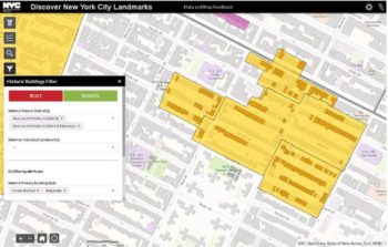
The enhanced version of the map was released as a part of the #LoveNYCLandmarks initiative. On May 7, 2020, the Landmarks Preservation Commission released an enhanced version of their online interactive map, Discover NYC Landmarks. The online map shows the location of individual landmarks, interior landmarks, scenic landmarks, and historic districts in the City. The map also has detailed information for individual buildings located within historic districts. The enhanced version of the map is … <Read More>
Council Subcommittees Hear Four Proposed Bills on Increasing Transparency in Land Use
The four proposed bills would provide the community and elected officials with the tools to make informed decisions about developments in their neighborhoods. On September 26, 2019, the City Council’s Land Use and Governmental Operations Committees held a hearing on four proposed bills that will increase transparency regarding new developments in the City, specifically with the transfer of development rights and testimony at the Board of Standards and Appeals. The four bills are a response … <Read More>


