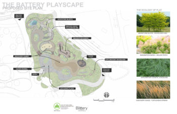
The Battery Playscape will cover 1.5 acres of waterfront space at the east end of Battery Park in lower Manhattan. On March 12th, 2020 NYC Parks Commissioner Mitchell J. Silver, Battery Conservancy President Warrie Price, and local elected officials and community members broke ground on the Battery Playscape reconstruction project. The Battery Playscape will be located at State Street and Peter Minuit Plaza in lower Manhattan.
Search Results for: Water Board
Public Hearing on Contested Industry City Expansion
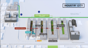
Despite two years of discussion, Industry City ownership unable to convince Council Member Menchaca and Community Board 7 to support expansion. On February 19, 2020, the City Planning Commission held a public hearing on an application for four land use actions to expand bulk and use requirements for Industry City, in Sunset Park, Brooklyn. Industry City is a 5.3 million square feet mixed-use complex comprised of sixteen buildings with commercial, manufacturing, and community facility uses. … <Read More>
CityLaw Profile: Caroline Harris – A Woman’s Journey to Land Use
Caroline Harris’s career as a land use attorney stems from an early interest in urban affairs and planning. Harris was born in New York City and grew up in Peter Cooper Village. As a student at the then all-female Hunter College High School, she started the first student volunteer program for Head Start, earning Mayor Lindsay’s award for “Distinguished Volunteer Supervision.” Harris spent five months in Israel before entering Trinity College, where she majored in … <Read More>
City Planning Approves Application for Development on Former Peninsula Hospital Site
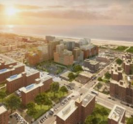
Edgemere Commons receives mixed reaction from the Rockaway community. On September 25, 2019, City Planning unanimously approved the Rockaway Limited Partnership’s application to redevelop an existing superblock in the Edgemere neighborhood of Far Rockaway, Queens. The site, which formerly housed Peninsula Hospital, is a paved over, impermeable surface lot located north of Rockaway Beach Boulevard, south of Beach Channel Drive east of Beach 53rd Street and west of Beach 50th Street. The development … <Read More>
City Planning Approves Two Applications to Facilitate the East Side Coastal Resiliency Project
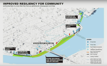
The project is predicted to protect over 110,000 Lower Manhattan residents from flood and storm impacts. On September 23, 2019, the City Planning Commission voted to approve two applications regarding the East Side Coastal Resiliency Project which addresses coastal flood vulnerabilities in Lower Manhattan. The project area is bounded by East 25th Street to the north, Montgomery Street to the south, and the East River to the east. The area runs along the FDR Drive … <Read More>
Proposed Rezoning to Bring 330 Affordable Housing Units to Astoria, Queens
The proposed development would be near Astoria’s waterfront parks and cultural institutions such as the Noguchi Museum. On September 11, 2019, the City Planning Commission voted to approve an application to develop three mixed-use buildings in Astoria, Queens. The project block is bounded by Vernon Boulevard and Broadway to the north, 33rd Road to the south, 11th Street to the east, and 10th Street to the west. The block is currently occupied by a one-story … <Read More>


