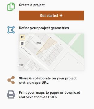
Front page of Applicant Maps website. Image Credit: NYC DCP
The new free self-service map tool increases accessibility for the public and smaller owners and developers. On Thursday, April 11, 2019, the Department of City Planning Director Marisa Lago announced the release of a free, easy to use digital mapping tool that allows the public, smaller property owners and developers to build quality land use maps for their applications to the City Planning Commission for zoning changes. Prior to the release of this tool, creating area maps was a costly venture, and required specialized Geographic Information System software, and the ability to use it.
The Applicants Maps tool allows applicants to include details of current zoning, their proposed zoning changes, and neighboring land uses and street dimensions when creating their area maps. Once the user selects an area, the tool adds layers of associated tax lot info, zoning, and land use information to the map.
The tool creates an efficient application process by creating better accuracy, clarity, ease of review and updating, and materials that are easier for the public to read when reviewing land use applications. DCP stated that it will continue adding additional required maps for applications, and will take user feedback into consideration for new features and updates.
“DCP’s newest digital mapping tool makes it easy to produce a professional land use map. This will streamline the public review application process, especially for smaller property owners, and continues DCP’s push to make land use tools more accessible to regular New Yorkers,” said DCP Director Marisa Lago.
By: Samantha Albanese (Samantha Albanese is a CityLaw intern, and a New York Law School student, Class of 2019).

