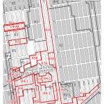
Middle Village and Glendale rezoned to allow in-context residential development. The Planning Commission approved another outer-borough rezoning intended to preserve established scale, protect low-rise character, and curb inconsistent development in residential neighborhoods. A majority of the rezoned area, 105 blocks along Metropolitan Avenue and the Long Island Railroad, will be predominantly rezoned R4-1 to allow only one- and two-family dwellings. Another 60-block area, bounded by Juniper Valley Road, Juniper Boulevard South, 78th Avenue, and 80th … <Read More>
City Planning Commission
Flight 587 Memorial Park
Site for the Flight 587 Memorial Park to be located 15 blocks from crash site. The Department of Transportation and Department of Parks and Recreation applied for a map amendment to establish a Memorial Park honoring the 265 victims who died when flight 587 crashed in Rockaway in November 2001. The site consists of .16 acres between Beach 116th Street’s southern turnaround and Ocean Promenade.
The map amendment would eliminate portions of Beach 116th Street … <Read More>
Modifications to High Line, West Chelsea district approved
Boundaries, frontage, easement access and lot coverage modified for High Line and Special West Chelsea district. In June 2005, the City Council approved several applications related to West Chelsea including the establishment of a Special West Chelsea District to support development of the High Line elevated public space, art galleries, marketrate housing, and affordable housing. 2 CityLand 83 (July 15, 2005). Public review of the proposed text amendments identified the need for additional modifications.
On … <Read More>
Two Bronx neighborhoods down-zoned
Pelham Bay and Westchester Square residents concerned that developers would move in after adjacent neighborhood was down-zoned. After the City down-zoned Throgs Neck in September 2004, 1 CityLand 4 (Oct. 15, 2004), residents of Pelham Bay and Westchester Square complained that the new limits on development in Throgs Neck would send developers north and westward into their communities, spurring over-development. While both communities are predominately developed with detached housing, the current zoning permits large apartment … <Read More>
Rezoning encourages medium- and low-rise development
Midwood rezoned to encourage appropriate higher density development. On February 22, 2006, the Planning Commission unanimously approved a rezoning impacting 80 predominantly residential blocks of Midwood, Brooklyn. The rezoning was proposed in response to out-of-scale development permitted by the R6 district’s community facility bonuses that increased FAR from 2.43 to 4.8. Designed to preserve the … <Read More>
82-foot telecom tower approved in residential district
Telecommunications tower will be disguised as a flagpole. Omnipoint Communications sought approval for an 82-foot telecommunications tower in connection with a proposed wireless communications facility to be built on a 2,597- square-foot site in the United Hebrew Cemetery on Arthur Kill Road between Clarke and Newvale Avenues. The facility will eliminate a gap in wireless services in the South Richmond area of Staten Island. The tower’s design calls for internal antennas so that it can … <Read More>


