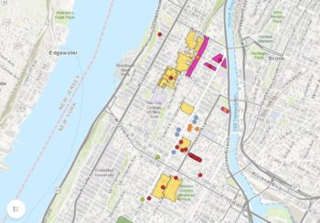
On November 22, 2023, the Department of Small Business Services announced the launch of Live NYC Map, an interactive database that includes a searchable map of the city’s small businesses and public-facing locations. The map launches ahead of Small Business Saturday, the part of the Thanksgiving holiday weekend where consumers are encouraged to explore and support local businesses for their holiday shopping.
Search Results for: interactive tool
City Planning Launches Interactive Map Reflecting Community and City Council District Overlaps
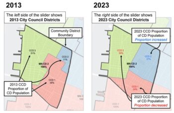
On September 7, 2023 the Department of City Planning released an interactive map showing Community and City Council districts overlap after the 2023 redistricting. This data allows communities to access information about who now represents them after the redistricting this year. The map also shows the proportions of changes to districts following the redistricting. This is the first time that communities can access data in an interactive map format.
LPC Celebrates LGBTQ+ Landmarks with Interactive Story Map
Released in honor of pride month, the story map features significant places like the Stonewall Inn. On June 16, 2022, the Landmarks Preservation Commission announced the launch of “Pride: Celebrating LGBTQ+ Landmarks”. This interactive story map highlights individual landmarks designated by LPC for their significant contributions to LGBTQ+ cultural and civil rights movements.
City Planning and HPD Seek Public Feedback on New Equitable Development Data Tool
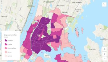
The tool aims to aid discussions and policymaking for creating affordable housing and preventing displacement. On February 22, 2022, the Department of City Planning (DCP) and the Department of Housing Preservation and Development announced the beginning of public engagement work for a new interactive tool, the Equitable Development Data Tool. The tool will allow users to examine housing, demographics, public health and other data, and compare that data across neighborhoods and racial and ethnic … <Read More>
Landmarks Launches Interactive Story Map to Celebrate Black History Month
The story map features highlighted landmarks and historic districts but also presents in-depth historical context about the significance of those sites. On February 9, 2021, the Landmarks Preservation Commission released Preserving Significant Places of Black History, an interactive story map that highlights New York City’s African American history through historic districts and designated landmarks.
Office of Environmental Remediation Announces Updated Mapping Tool
The updated SPEED tool will give community a better understanding of development and environmental measures taken in their neighborhood. On April 23, 2020, The Mayor’s Office of Environmental Remediation released an update to its SPEED environmental mapping tool. The SPEED 2.0 environmental mapping tool allows New York City property owners, developers and community members to create maps of environmental information at a city, borough, neighborhood or site level. All of SPEED’s data is regularly updated … <Read More>


